Maps of Nicaragua

Forest Cover in Nicaragua
Although this map mainly shows the amount of tropical rain forest cover disappearing, we can also see that the tropical dry forests – located mainly on the western side of the country – have been wiped out as well. Causes for this include deforestation and land clearing in order to make space for farming, agriculture, coffee plantations and other human activities.
(http://www.sonati.org/images/for1.jpg)

Natural Ecosystems of Nicaragua
This natural systems map shows the parts of the country where certain natural ecosystems occur. Tropical dry forests, defined as forests with dry seasons of about 7 months and rainfall between 500 and 2000 mm, are located on the eastern side of the country and surround most of Lake Nicaragua. Nicaragua is dominated by rain forests, with the second largest ecosystems in terms of land area is easily the tropical dry forest.
(photo from http://www.sonati.org/images/for3.jpg)

Land Utilization and Vegetation
This map shows the different land use and vegetation throughout Nicaragua. The eastern part of the country is largely dense rain forests and for the most part, not yet developed. However, if we look at the eastern part of the country, where most of the tropical dry forests of the country are found, we see that there are large plots of cultivated area scattered throughout this land. These plots of cultivated land are necessary for the development of the country but are also destructive to the environment and the natural habitats of thousands of species.
(http://en.academic.ru/pictures/enwiki/78/Nicaragua_land_1979.jpg)

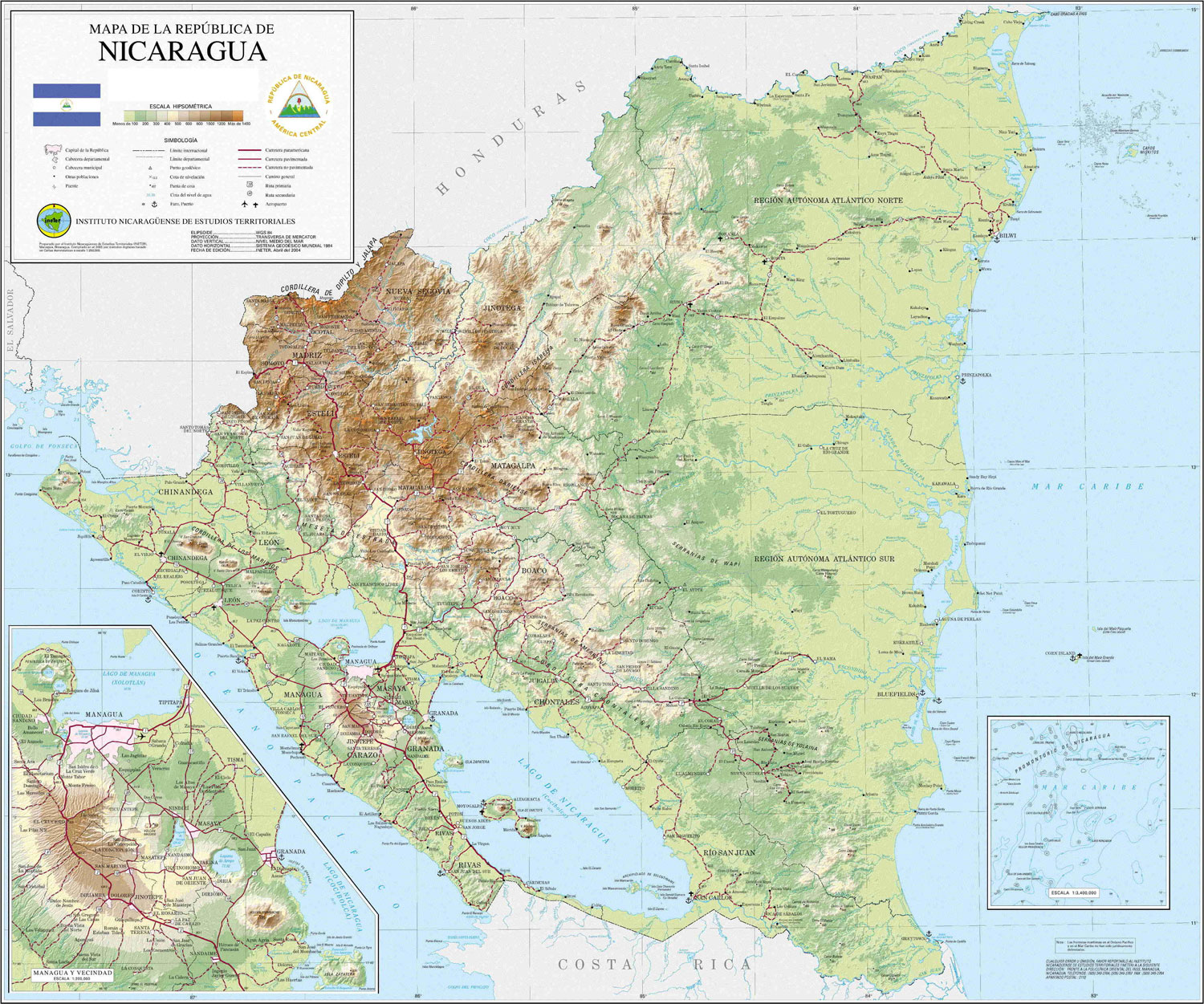
Elevation of Nicaragua
This relief map shows the elevation of Nicaragua. The scale shown correlates to elevation by increasing hue: from light green (low elevation) to dark brown (highest elevation). This map shows roads throughout Nicaragua, corresponding Nicaragua's development as a country. The most developed areas of the nation appear to be areas where tropical dry forests are the most prominent and where society can be most productive.
(http://www.aurorabeachfront.com/nicaragua_images/Mapa-Nicaragua-Relieve.jpg)

Satellite Image of Nicaragua
This is a satellite image of the entire country of Nicaragua. Perhaps it is because of the development of the country, but it seems like the country isn’t mapped with as much detail as, for example, areas in the United States. However, it is still possible to see that the majority of the country is covered with many acres of forest and preserved natural area.
(source: Google: Earth)
